Beltrami County
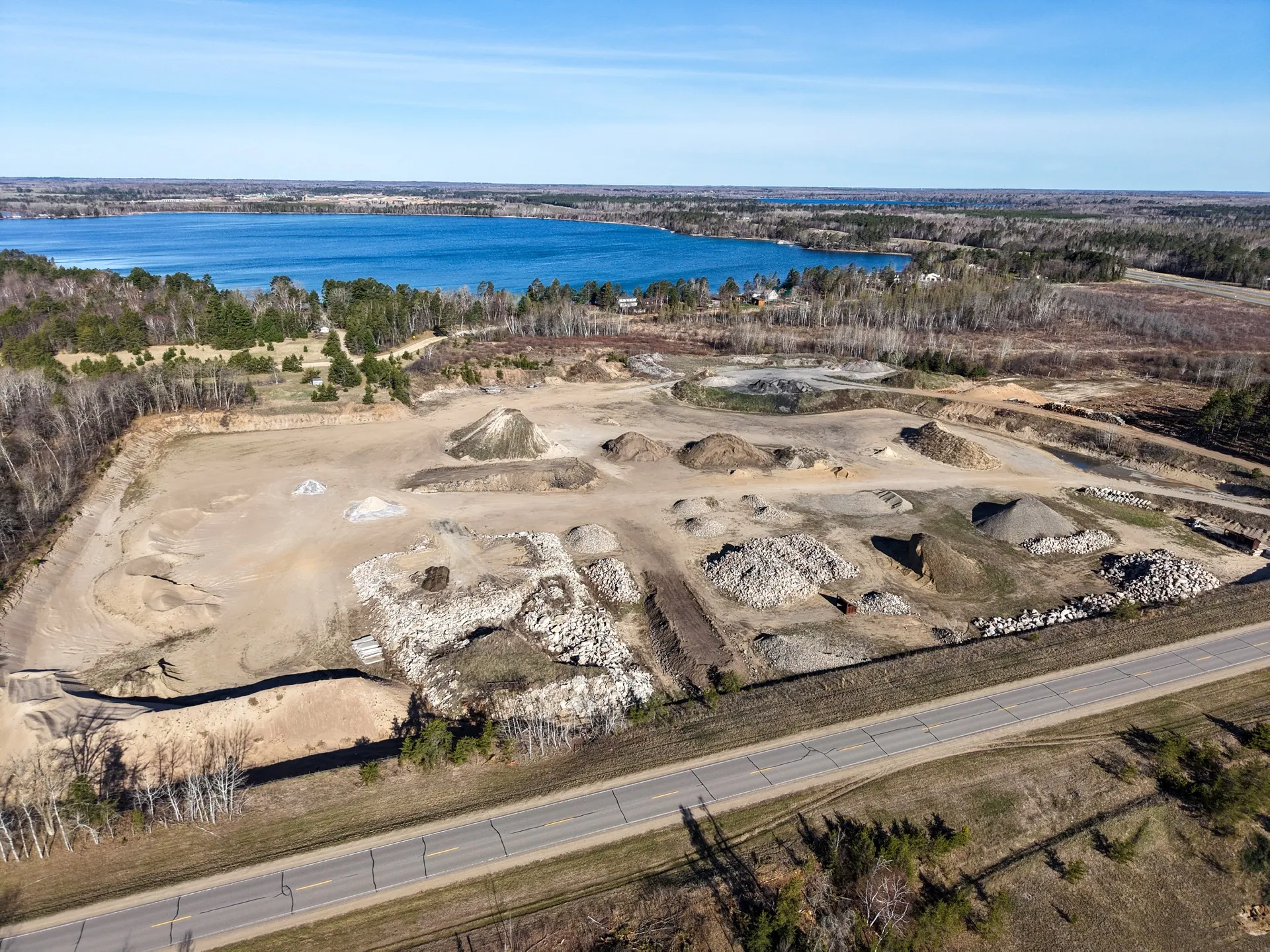
Site Documentation Imagery in Bemidji, Minnesota
Aerial site overviews and exterior documentation.
Site Documentation in Bemidji
Beltrami County contains substantial rural and semi-rural acreage that benefits from aerial documentation: timber parcels, agricultural land, gravel pits, and undeveloped lakefront lots. Landowners, attorneys, and title companies handling rural property transactions in the area have found aerial documentation useful for establishing current site conditions and boundary context.
Sometimes the need is documentation rather than marketing. A landowner wants a dated visual record of their parcel before a boundary dispute gets complicated. A contractor needs site overviews for their project file before clearing begins. A municipality wants current imagery of a property before a zoning decision. A gravel pit operator needs to document current excavation extent. Aerial site documentation answers all of these needs efficiently and permanently.
A ground-level walk cannot cover a 40-acre parcel in an hour and produce a usable record. Aerial can. Top-down overview imagery and wide-angle perspective shots capture everything from drainage patterns and structure locations to road access and property boundary context in a single flight. The result is a dated, organized file archive that holds value for as long as the property exists.
We are not a certified survey firm and do not produce engineered drawings, topographic data, or LIDAR deliverables. Site Documentation Imagery is visual reference — the kind of documentation that informs decisions, supports conversations, and creates a dated record for owners, contractors, attorneys, and planners who need to see what is actually on a piece of ground.
Why aerial
Walking a site cannot produce the same record as flying it. Aerial documentation shows the relationship between structures, the extent of cleared areas, drainage patterns, and boundary context that is invisible from the ground. For any parcel larger than a few acres, aerial is the only practical way to document the whole site in a single visit.
What you get
- Complete top-down and perspective coverage of the full site
- A dated, organized file archive suitable for project records
- Visual reference for contractors, attorneys, planners, and property owners
- Before-and-after documentation for sites undergoing change
- A permanent visual record that has value for years after the shoot
When to commission
Before any significant change to the site — before clearing, before construction begins, before a sale or transfer, or before a dispute becomes a legal matter. Documentation taken after a problem starts is never as useful as documentation taken before.
Summer is the peak season for resort and tourism work — dock-in typically happens in early May and the main season runs through Labor Day. Fall brings reliable leaf color and good light for estate and property work. Winter shoots are viable but cold-weather battery limits apply. Avoid scheduling critical shoots in March and April before ice-off is confirmed.
Working policies
-
Weather reschedules included
One weather reschedule is built in. We never deliver footage we wouldn’t put our name on.
-
One revision round included
Edits land within the agreed deliverable count. Any additional rounds are spelled out in your proposal.
-
Clear, written terms up front
Scope, schedule, and terms are confirmed in a written proposal before anything is booked. No surprises.
-
Standard commercial usage rights
Full commercial usage of finished deliverables for your business. Resale, broadcast, and paid ad licensing quoted as add-ons.
-
Insurance certificates on request
Commercial liability insurance carried on every shoot. We’ll send the COI before you ask.
Site Documentation in Bemidji
Working on a Bemidji project?
Share a few details about the property, the goal, and the timeline. We respond within one business day with a recommended scope and a clear proposal.